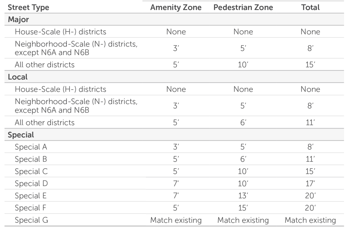
This map designates different street types solely for the purpose of applying the regulated streetscape requirements (e.g., sidewalks) associated with new development. These street types do not represent or replace roadway functional classifications.
The street types—and their corresponding standards—are shown below.
To find a specific property, enter the address in the search box in the bottom-left corner of the map.
Click the legend icon on the left to view the map legend, turn layers on or off, or adjust their order. We recommend turning off the "Tax Parcel" layer for improved clarity.
You can still share your comments through April 8, 2026. A final version (Draft V3) will then be prepared for City Council consideration.
Thank you for helping shape Atlanta's new Zoning Ordinance.
>>> Click here to review or download PDF version of this map <<<
Comments
Cancel